Dr. Md. Mizanur Rahman
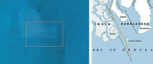 The South Talpatti measuring 81 square miles in the Sunderbans has disappeared due to sea level rise and soil erosion. Its disappearance was confirmed by satellite image and sea patrols. Sugata Hazra, a professor from the School of Oceanographic Studies at Jadavpur University in Calcutta, told reporters, “There’s no trace of the island any more,” He noted that temperatures in the region had been rising at an annual rate of 0.4C. Until 2000, the sea level rose about 3mm a year, but over the last decade it had been rising about 5mm annually, he said. He warned that another ten islands could be at risk.
Another study showed that at Sundarbans island chain, where South Talpatti was situated; sea level has been rising by about 3.14 centimetres a year. A nearby island, Lohachara, was submerged in 1996, forcing its inhabitants to move to the mainland, while almost half of another island, called Ghoramara, is now under water. South Talpatti is the fifth island in the Sundarbans to sink into the sea preceded by Bedford, Lohachara, Kabasgadi, and Suparibhanga (Rice 2010). Another five inhabited islands in this delta region, where South Talpatti is located, could disappear in the next 10 years (Hazra 2010). The Namkhana island about 8 square kilometers while Sagar island has lost about 12 square kilometers. The study says that about 15% area of Sagar Island will be lost in the next 14 years (ITN 2009).
Bangladesh, a low-lying delta country will be highly affected by global warming. It is assumed that 18% of its coastal area will be submerged and 20 million people will be displaced if sea levels rises 1 metre by 2050 as projected by some climate models. 84% of the Sundarbans, the world’s largest mangrove swamp, located between Bangladesh and India, would be inundated by 2050 even at conservative estimates such as a 32cm rise (IPCC reports 2009). The net sea level rise in the Sunderbans territory is about 3.1 mm per year for being a subsiding delta, while the sea level rise is only 2 mm per year globally. A sea level rise of 45 cm will lead to the destruction of 75% of the Sundarbans mangroves (New UNESCO report 2010).
Actually there is no way to measure the cause and effect of small islands ending up in the ocean accurately. It is difficult to assume the future sea-level rise. Melting polar ice and the expansion of ocean water as it gets warmer are the two main causes of this rise. Both are the result of global warming. Considering the satellite and other data, it has been assumed that 50% to 80% of the rise is due to melting of ice. It will be not a smooth curve as we don’t know how individual sea basins will react. But it is true that we are travelling on a path towards less ice and more water in the oceans. Ice-melt is accelerating in between ‘fast and faster’ rates (Rahmstorf 2009).
The current level of atmospheric CO2 is 385ppm, and could exceed 450ppm; if left at that level, all the ice will melt causing an enormous sea-level rise (Hansen 2009). The rising of atmospheric CO2 level occurs largely from burning fossil fuels. It’s noteworthy to mention that changes in sea level do not occur uniformly round the globe. Sea level rise differs from place to place due to ocean circulation and wind pressure patterns. The severity of storm surges and spring tides need to be kept in mind to evaluate the sea level rise impacts.
The occurrence of El Nino or Southern Oscillation phenomenon has intensified since the 1980s. New studies have projected a higher and faster sea level rise by the next century. The new projections in sea-level rise caused by accelerating rates of iceberg loss from poles hint increase of global temperatures very quickly. The sea level rise because of melting of ice, glaciers and iceberg causes thermal expansion of water. Sea levels rose 2cm in the 1700s, 6cm in the 1800s and 19cm in the 1900s (UNEP Year Book 2009). A sea-level rise of 50 cm projected for the next 100 years is expected to occur mostly in the second half of the next century (Natural Environment Council of UK 2009).
Dutch Delta Commission also projected a high sea level rise ranging from 0.55m to 1.10m by 2100 and from 1.5m to 3.5m by 2200. The impact of the sea-level rise is gradually coming into broad daylight. About 70 percent of the world’s population lives on coastal areas, and 11 of the world’s 15 largest cities are located on the coasts or estuaries.
Island states such as the Papua New Guinea have been already feeling the impact. During 2005, 1,000 residents on Carteret atoll of Papua New Guinea had to be shifted as the rising sea level was slowly drowning their land. Tuvalu, a tiny island country in the Pacific Ocean midway between Hawaii and Australia has experienced lowland flooding as sea level has risen. Saltwater intrusion has adversely affecting its drinking water and food production. Coastal erosion has been eating away the nine islands that make up the country. At last, Tuvalu people have conceded defeat in the battle with the rising sea by abandoning their homestead.
The Maldives, an island nation in the Indian Ocean, has been losing her land mass to the sea for years. During 1987 the President of the Maldives declared his country as “an endangered nation” due to rising sea level. Even cities like London, Bangkok and New York will be disappeared below sea level if current warming trend continues. The historical city Alexandria of Egypt will be inundated by a one meter sea level rise.
The survival of the Sunderbans delta would be in jeopardy with even a 1-meter rise in sea level in the event of a storm surge. During 2000 World Bank published a map showing that a 1-meter rise in sea level would inundate half of the rice land of Bangladesh. The Ganges delta (Sunderbans) comprises of a network of 108 swampy and low-lying islands (Cockburn 2010). This area is unique both ecologically and culturally. This region of low elevation above sea-level and its proximity to the coast made it vulnerable to storms. Climate change and human interference will destroy much of Sundarbans in India and Bangladesh as well as 25 other World Heritage site.
Sea-level rise is the greatest threat and challenge for the Southeast Asia. Minimum sea level rise will cause flooding of low lying islands, intrusion of salinity, acidification of soils and change the level of water tables. The ecosystems of swampy mangroves and the dune biodiversity will be fully destroyed. The problems due to climate change will be made much worse by more severe storm surges, droughts and floods in the Sunderbans territory (Harrabin 2007). Currently, 12 sea facing islands in this delta are experiencing erosion. The tides have increased in number, leading to breach of river embankments and saline water intrusion (ITN 2009).
Once set in motion, perhaps it is impossible to stop sea-level rise. The only chance we have to limit sea-level rise is by reducing emissions very quickly. This effort needs natural and social scientists to work together and to find out an integrated approach to how we project our future to unfold. The integrated approach may include the following steps:
Adopting an integrated approach to issues of environmental preservation and sustainable development
o Assessing vulnerability through analysing ecosystem sensitivity and adaptive capacity of both people and biodiversity
o Using human-environment models such as LPJ-DGVM for analysing sensitivity
o Determining the changes in habitat-biomes relationships by using GVM simulation model
o Mapping the native and endemic species of this territory
o Initiating a database system of biological responses to climate change
o Examining the change of species distribution, the rate and direction of species dispersal, population density ,growth, dispersal distances and the location of ‘refuges’ to climatic amelioration
o Examining the temporal variation of the responses of the biota in changing environmental conditions to find some indication of the predicted responses
o Using Dutch technology to prepare dam in the coastal areas
o Working with the flow of sediment and accelerating the accretion of new lands
o Investing to make seawalls and other coastal protections to reduce vulnerability sharply
o Developing vulnerability information system which can guide stakeholder approaches to understanding the future for ecosystem services, coping mechanisms and interactions, and facilitate sustainable management
o Examining changes in biome areas under two scenarios: 1) shifts in biomes kept pace with shifts in climatic conditions and 2) biomes fail to shift to new areas due to migration limitation
* Finding ways to exploit the eroding Himalayas as a way to counter the erosion of the coasts
* Reducing CO2 emissions, and nitrogen and phosphorus deposition at all levels
* Adopting the triage approach of prioritising species and habitats conservation
* Exploring habitat restoration opportunities
* Emphasising on reforestation and afforestation to accelerate carbon sink
* Initiating dialogue between scientists and different stakeholders
* Planting appropriate mangrove species, as a bio-shield
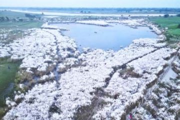
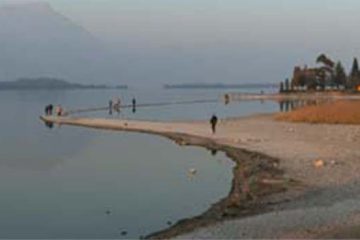
Image Caption: Disappearing South Talpatty(left)
Dr. Md. Mizanur Rahman, a biodiversity specialist, NDC, Jhalakathi Collectorate.
E-mail: mizan_peroj @yahoo.com

