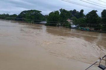
The flow of water in Sangu, one of the prime rivers of Bangladesh has been affected due to heavy landslide in Ruma upzila of Bandarban. The authorities could not remove the debris from the river till this afternoon.
A large chunk of a hill comprising stones and earth collapsed in the river Sangu on Wednesday night affecting the normal flow the river. A large portion of hill of about 500 feet high named Walutehang, near Galenga para under Ruma Upazila, suddenly crumbled into the river at about 5 am.
The District Council Chairman of Bandarban Hill District Thanjama Lusai and Deputy Commissioner (DC) of Bandarban Mizanur Rahman and other top officials visited the spot today. The team led by Thanjama Lusai will submit report to the government, sources said.
According to the district administration and locals, the flow of water of Sangu is increasing at Galengya to Bottoli Char area now. But, the flow of water of Sangu is decreasing alarmingly at Ruma, Roangchari and nearby areas in Banderban hill district in the current dry season. The Chairman of Ruma Upazila, Aung Thoai Ching Marma, member of District Council Chingsha Pru Kessi, Upazila Nirbahi Officer of Ruma Abu Nayem also visited the spot and saw the flow of water in Ruma and Roangchari area in Bandarban yesterday.
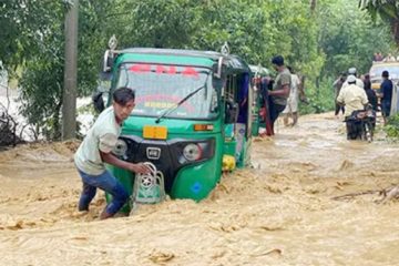
According to eyewitnesses, a large portion of the hill is obstructing the current of the river Sangu as it has completely filled up the river. Following the collapse of the hill, the flow of river Sangu at that point has totally stopped. As a result, the movement of riverine transport in the downstream of the river has been suspended. Besides, the water flow of the river Sangu in the upstream has flooded a large area of the Upazila.
The local people and the local administration could do nothing to remove the chunk of the hilly stones due to their size. The eyewitnesses said, the landslide has virtually created a dam in the river obstructing the normal flow of the river.
Local tribal farmer of Roangchari Abo Mong Marma, Ulaching Marma, Dewai Mro, Doung Hri Marma told journalists that the natural flow of Sangu was hampered due to unplanned hill cutting and pollution. They feared that if river Sangu was not alive, the living of the hill people and the tribals would be at risk as they were dependent on it. The slide filled up at least 10 feet of the 25-feet wide length river, they opined.
It may be mentioned that Sangu River has its source at 21°13´N and 92°37´E in the North Arakan Hills, which form the boundary between Arakan and Bandarban of Chittagong Hill Tracts. The Sangu follows a northerly circuitous course in the Hill Tracts up to Bandarban. It enters the district from the east and flows west across the district and finally falls into the Bay of Bengal at the end of a course of 270 km (173 km within Bangladesh territory), at the mouth of the rive Karnaphuli.
The principal tributary of the Sangu is the Dolukhal, which drains the Satkania plain. The Chand Khali flowing through the Patiya plains also joins it on its right-bank. Further down, it is joined by the Kumira Khali and ultimately falls into the Kutubdia Channel. The Sangu is, therefore, a very important river in so far as it drains the waters of three important upazilas Potiya, Satkania and Banshkhali in Chittagong.
Original Article on The Independent


